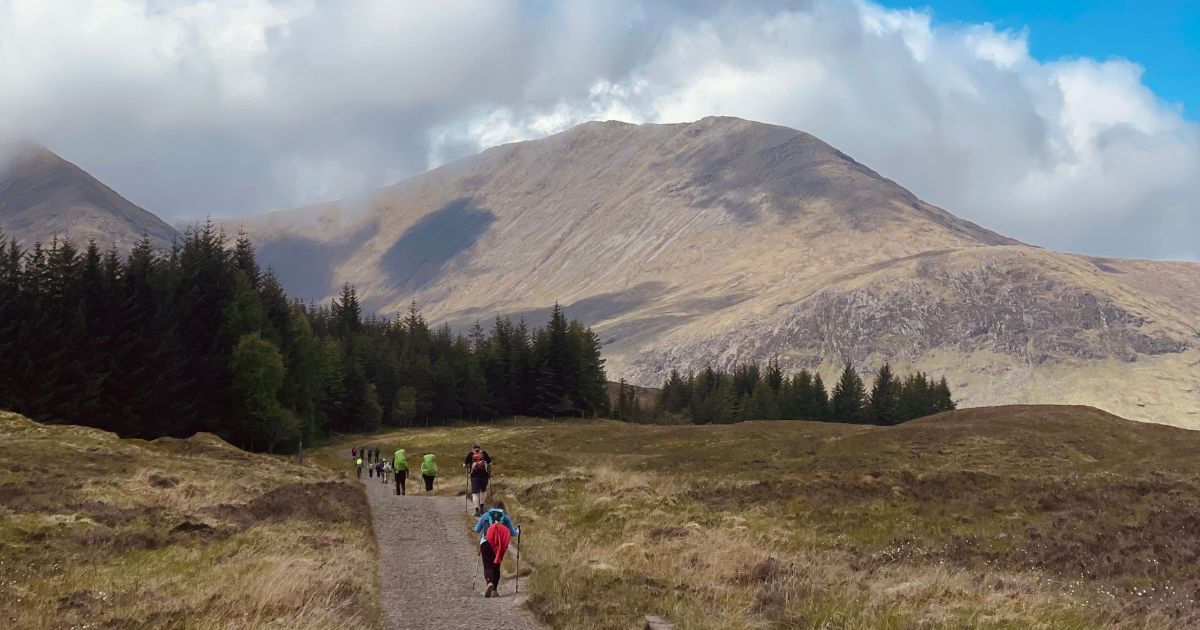
Walkers on the West Highland Way across Rannoch Moor
Rannoch Moor

Inveroran to Kingshouse

Rannoch Moor. Exposed, empty, and the weather day.

  • 15.5 km 9.6 mi On trail
  • 4–5 h Walking time
  • ↑320 m 1,050 ft Ascent
  • Harder Difficulty

Example stay Kingshouse Hotel (opens in a new tab)

Cross-check: official Inveroran to Kingshouse section . We use their settlement names and amenity list as a cross-check. Distances are from our trail geometry, not their mile table.

The walk

From Forest Lodge the old Parliamentary road rises onto Rannoch Moor. Official guidance calls this one of the last great wildernesses in Europe. On a fair day the walking is straightforward. In foul weather it is exposed, with no shelter until the Glencoe Ski Centre. Ba Bridge is halfway. The ruins of Ba cottage sit just beyond. Then the track undulates past the ski centre and Black Rock Cottage, with Buachaille Etive Mor ahead, to the hotel at Kingshouse.

  1. Start of section

    Inveroran

    The hotel is the place. A handful of buildings. No shop.

    56.5329, -4.8075 Google Maps for Inveroran (opens in a new tab)

  2. Onto Rannoch Moor

    From Forest Lodge the track climbs slowly onto open moor. The path is good. The country is empty. On a clear day the mountains sit on every horizon. In cloud or wind there is nowhere to hide.

  3. Lunch

    Ba Bridge

    Halfway across. An obvious rest on a stone arch over the River Ba. A short way on, the ruins of Ba cottage may give a little shelter. Official guidance calls it bleak and beautiful, depending on the day.

  4. Buachaille Etive Mor

    The ski centre is the first food and toilets after the moor. Black Rock Cottage sits nearby. Buachaille Etive Mor fills the view as you drop toward Kingshouse at the edge of Glencoe.

    56.6320, -4.8280 Google Maps for Glencoe Ski Centre (opens in a new tab)

  5. End of section

    Kingshouse

    The hotel is the place. Isolated, booked out in summer, and the usual night before the Devil's Staircase.

    56.6510, -4.8402 Google Maps for Kingshouse (opens in a new tab)

Section overview

The ground

  • Old military road
  • Exposed moor
  • Good track
  • No shelter

Good track. The test is exposure and weather, not footing. The rocky north shore is slow underfoot. The Devil's Staircase is the steep pull. This is the empty, weather day.

Stops

Refreshments

  • Inveroran
  • Glencoe Ski Centre
  • Kingshouse

Toilets

  • Glencoe Ski Centre
  • Kingshouse

Before you go

Get there

Southbound, you finish at Inveroran. The nearest train and coaches are at Bridge of Orchy.

Opposite direction

Kingshouse to Inveroran

If you walk the Way from Fort William to Milngavie, this is the stretch that leaves Kingshouse and crosses Rannoch Moor toward Inveroran. Same Parliamentary road and emptiness as the northbound day. Ba Bridge is still the middle. Inveroran is a quiet hotel night before the glen.

End of section

Inveroran

The hotel is the place. A handful of buildings. No shop.

56.5329, -4.8075 Google Maps for Inveroran (opens in a new tab)

Inveroran to Kingshouse FAQ

How do I get to the start in Inveroran?
There is no bus at the hotel. The nearest train and coaches are at Bridge of Orchy, a short walk back over the hill. Maps and coordinates are under Get there in Section overview.
How hard is Inveroran to Kingshouse?
Underfoot it is easy: a good old road. The hard part is exposure. There is no shelter until the Glencoe Ski Centre. In fair weather it is straightforward. In foul weather it is the weather day of the Way. The rocky north shore is slower underfoot. The Devil's Staircase is the steep pull.
How long does Inveroran to Kingshouse take?
Most people take 4–5 hours, plus a stop at Ba Bridge. No preset walks this official pair as its own day. On the 7-day it is the second half of Day 5, after Tyndrum and Inveroran. The 8- and 9-day walk it after a night at Bridge of Orchy.
Is Kingshouse on the West Highland Way?
Yes. The hotel sits on the path at the edge of Glencoe, under Buachaille Etive Mor. Isolated, booked out in summer, and the usual night before the Devil's Staircase.
Where should I stay after this section?
Kingshouse Hotel is the official end and the usual night on the 7- to 9-day splits. Book ahead in summer. The 5- and 6-day continue over the Devil's Staircase to Kinlochleven the same day. The ski centre also has beds if the hotel is full.
Can I download a GPX for Inveroran to Kingshouse?
Yes. Open the 7-day itinerary in the planner (free, no account). This stretch is the second half of Day 5. Download a full-route GPX or per-day files for Garmin, Komoot, or your phone.

Walk this as a day

This official stretch is the second half of Day 5 on the 7-day, after Inveroran. On the 8- and 9-day it is the moor after Bridge of Orchy. Open the planner on that preset, then export a full-trip or per-day GPX.

Open in planner Read the 7-day itinerary

Full-trip and per-day GPX files. Free, no account.

Pinch or scroll to zoom · drag to pan · double-tap to reset